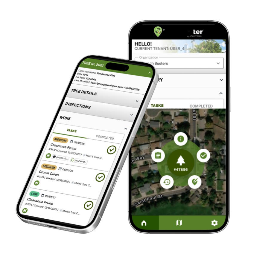
 TreePlotter™ Software Suite by PlanIT Geo™ is the industry’s leading web-based GIS platform for urban forestry and green asset management. Built for municipalities, consultants, and non-profits, TreePlotter simplifies the way organizations map, manage, and analyze trees and natural assets using real-time data accessible from any device, online or offline.
Developed by certified arborists, TreePlotter brings together three flagship products designed to work independently or as an integrated system. TreePlotter INVENTORY is a comprehensive GIS-based tool for field data collection and asset management, giving unlimited users convenient access to tree maps, dashboards, standard and configurable reports, complete work history, and advanced dataset queries from any web-enabled device. TreePlotter CANOPY supports canopy assessment and analysis, helping organizations understand tree cover at a landscape scale and distinguish that insight from the parcel-level detail an inventory provides. TreePlotter Projects ties both together into a single planning and tracking system, allowing teams to break large-scale initiatives into manageable, measurable objectives, complete with automated progress tracking and streamlined grant and compliance reporting.
From tree inventory and risk assessment to asset management, work orders, and reporting, TreePlotter empowers teams to improve efficiency, transparency, and decision-making at every stage of urban forest management. A suite of add-on modules extends this further, including tree risk assessment, tree appraisal, and work order management, so organizations can tailor the platform to their specific workflows rather than adapting their processes to fit the software. Single Sign-On (SSO) integration and API access give IT departments and developers the flexibility to connect TreePlotter to existing authentication systems and internal tools, while scalable product tiers mean organizations of any size, from small municipalities to large metro areas, can find the right fit.
Because TreePlotter is fully web- and mobile-based, field crews can collect and update data in real time, whether they’re online or off, and that information is immediately available to office staff, decision-makers, and the public through shareable maps and dashboards. This live, centralized approach to data eliminates the lag between fieldwork and reporting that slows down traditional, paper-based or siloed systems, and it reduces the need for specialized equipment since data collection works on any standard device with an internet connection.
With this software, PlanIT Geo enables cities and organizations to put urban forest data to work, improving operational efficiency, optimizing limited resources, and supporting healthier, more resilient communities. Organizations gain not just a mapping tool, but a full operational system for managing the lifecycle of their urban forest: from initial inventory and risk assessment, through active management and work order execution, to long-term canopy planning and public-facing reporting. Backed by a support team with a track record for responsiveness, TreePlotter customers get both the technology and the partnership needed to turn urban forestry data into measurable, on-the-ground results.